City, County, and State Boundaries
- Category: Boundaries
- Data Type: GIS Data Layer
- Steward(s): UGRC, State and Local Government Partners
- Web Application: View
- Abstract: This dataset contains mapping data representing the state, county, municipal, and metro township boundaries for Utah.
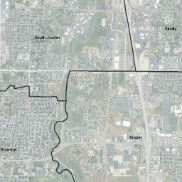
Municipal Boundaries

Municipal Boundaries is a multi-purpose statewide dataset of municipal boundaries for cartography and approximate boundary identification.
Municipal Boundaries are maintained by UGRC with the help of many state, county, and local entities. Changes and updates are through certification by the Lt. Governor’s Office sent in by City and County Recorders offices. All features are adjusted to the current Geographic Coordinate Database (GCDB) points.
Data developed with coordinate geometry (COGO) from legal descriptions were used. When necessary the data was adjusted to conform to known physical features. This dataset does not represent exact legal boundaries, but, rather a set of boundaries used for the administrative purposes that conforms to logical & administrative rules (e.g. no two cities or redevelopment areas may cover the same geographic extent).
The native spatial reference for this dataset is UTM Zone 12N, NAD83 (0.01 meter coordinate precision).
There are no constraints or warranties with regard to the use of this dataset. Users are encouraged to attribute content to: State of Utah, SGID.
The municipal boundary dataset is maintained by UGRC in partnership with state and local government.
Related Resources
- Lieutenant Governor Municipal Certifications website
- Utah Municipalities and Metro Townships Boundaries Map
- Utah Municipality Modifications Map
Comments, questions, compliments, or concerns can be directed to Mike Heagin from UGRC at MHeagin@utah.gov or 385-401-9667.
Downloads and Web Services
Updates
Updates to this dataset are published at a monthly interval or as needed.
Metro Townships

MetroTownships is a multi-purpose statewide dataset of metro townships boundaries for cartography and approximate boundary identification.
MetroTownships represent unincorporated locations where the residents don't want to be part of an incorporated municipality but do want some say in how they are governed. They are maintained by UGRC with the help of many state, county, and local entities. Changes and updates are through certification by the Lt. Governor’s Office sent in by City and County Recorders offices. All features are adjusted to the current Geographic Coordinate Database (GCDB) points.
Data developed with coordinate geometry (COGO) from legal descriptions were used. When necessary the data was adjusted to conform to known physical features. This dataset does not represent exact legal boundaries, but, rather a set of boundaries used for the administrative purposes that conforms to logical & administrative rules (e.g. no two cities or township areas may cover the same geographic extent).
The native spatial reference for this dataset is UTM Zone 12N, NAD83 (0.01 meter coordinate precision). There are no constraints or warranties with regard to the use of this dataset. Users are encouraged to attribute content to: State of Utah, SGID. The metro townships boundary dataset is maintained by UGRC in partnership with state and local government.
Related Resources
Comments, questions, compliments, or concerns can be directed to Mike Heagin from UGRC at MHeagin@utah.gov or 385-401-9667.
Downloads and Web Services
Updates
- Update to Magna Metro Township October 2018
- Updates to this dataset are published as needed.
County Boundaries

County Boundaries is a multi-purpose statewide dataset of county boundaries for cartography and approximate boundary identification. Includes July 2012 major update of Millard and Juab counties.
County Boundaries are maintained by UGRC with the help of many state, county, and local entities. Changes and updates are through certification by the Lt. Governor’s Office sent in by City and County Recorders offices.
Data developed with coordinate geometry (COGO) from legal descriptions were used. When necessary the data was adjusted to conform to known physical features. This dataset does not represent exact legal boundaries, but, rather a set of boundaries used for the administrative purposes that conforms to logical & administrative rules.
The native spatial reference for this dataset is UTM Zone 12N, NAD83 (0.01 meter coordinate precision). The county boundary dataset is is maintained by UGRC in partnership with state and local government.
Related Resources
Comments, questions, compliments, or concerns can be directed to Mike Heagin from UGRC at MHeagin@utah.gov or 385-401-9667.
Downloads and Web Services
Updates
- November 2020 (Davis and Weber Counties Adjust Shared Boundary)
- July 2014 Adjusted to newest CadNSDI v2 PLSS-GCDB; minor adjustments 10 ft to 40 ft all in non-populated areas.
- July 2012 (Juab and Millard Counties Adjust Shared Boundary)
- November 2011
- March 2011
Utah State Boundary

Utah State Boundary is a dataset of the Utah state boundary.
Utah State Boundary is maintained by UGRC with the help of many state, county, and local entities. Changes and updates are through certification by the Lt. Governor’s Office sent in by City and County Recorders offices. All features are adjusted to the current Geographic Coordinate Database (GCDB) points.
Data developed with coordinate geometry (COGO) from legal descriptions were used. When necessary the data were adjusted to conform to known physical features. This dataset does not represent exact legal boundaries, but, rather a set of boundaries used for the administrative purposes that conforms to logical & administrative rules.
In addition to the boundary of the state of Utah this dataset contains another larger boundary around the state that can be used for cartographic purposes to mask other data layers that extend past the boundary of the state. The native spatial reference for this dataset is UTM Zone 12N, NAD83 (0.01 meter coordinate precision). The state boundary dataset is is maintained by UGRC in partnership with state and local government.
Downloads and Web Services
Updates
- July 2014 Adjusted to newest CadNSDI v2 PLSS-GCDB; biggest shift along Wyoming & Summit County line (47 ft)
- November 2011
- March 2011