Demographic Data
- Category: Demographic
- Data Type: GIS Data Layer
- Steward(s): UGRC and U.S. Census Bureau
- Abstract: This page contains boundary and demographic data collected by the U.S. Census Bureau for 2020, 2010 and 2000 censuses. Demographic data includes population counts, household counts, ethnicity counts, etc. The data available on this page is filtered, geographically, to the state of Utah. This data follows the format released by the Census Bureau, with just a few modifications for usability.
Read about commonly-used Census Bureau geography including blocks, block groups, tracts, and places.
2020 U.S. Census Bureau Data

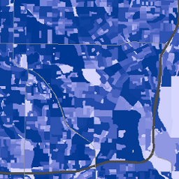
The data in this section contains census blocks, census block groups, census tracts, census places, census counties, and the state boundary from the Census Bureau.
Utah’s 2020 census geographic boundaries became available in February 2021 and the demographic redistricting legacy files (the 2020 Census Redistricting P.L. 94-171 Summary Files) became available on August 12, 2021. The Census Bureau will release a more user-friendly version of the 2020 Census Redistricting P.L. 94-171 Summary Files on September 30, 2021. In the meantime, UGRC, with collaboration from the Analytics Group at WFRC, has worked with the August 12 release and has created ready-to-use GIS data in several formats that hopefully make the 2020 redistricting data easier to use. Read more about these offerings in the blog post, 2020 Census Redistricting Data in Easy to Use GIS Formats
The 2020 data available on this page was downloaded from the 2020 Census Redistricting Data (P.L. 94-171) page. All 2020 census geographies reflect boundaries as of January 1, 2020. Additional GIS files and support products are available on the census redistricting data page.
Geography is a fundamental aspect of the census, providing the framework for the once-a-decade count of population and housing. Read about some of the key geography changes in the Kem C. Gardner Policy Institute's 2020 census geography blog and fact sheet.
There are no constraints or warranties with regard to the use of this dataset.
Related Resources
- 2020 Census Redistricting Data (P.L. 94-171)
- 2020 Census Redistricting Data (P.L. 94-171) TIGER/Line - Technical Documentation
- 2020 Census State Redistricting Data Summary File - Technical Documentation
- 2020 Census Redistricting Data (P.L. 94-171) Field Names and Descriptions (Excel spreadsheet)
- The Census Redistricting Data Program
- U.S. Census Bureau
- 2020 Census Redistricting Data for Utah in Easy to Use GIS Formats
- Kem C. Gardner Policy Institute 2020 Census page
Comments, questions, compliments, or concerns can be directed to the staff from UGRC at ugrc@utah.gov or 801-538-3665.
Downloads and Web Services
Updates
- August, 2021
2010 U.S. Census Bureau Data
The Census Bureau creates different sized geographic areas to organize this demographic information, the smallest unit of area being a "census block" and the biggest being counties. The data in this section contains census blocks, census block groups, census tracts, and counties.
There are no constraints or warranties with regard to the use of this dataset.
Related Resources
Comments, questions, compliments, or concerns can be directed to the staff from UGRC at ugrc@utah.gov or 801-538-3665.
Downloads and Web Services
Updates
- January, 2011
2000 U.S. Census Bureau Data
This dataset contains demographic information collected by the Census Bureau in 2000 for the census block, census block group, census tract, and county levels. Demographic population includes population counts, household counts, ethnicity counts, etc. The Census Bureau creates different sized geographic areas to organize this demographic information, the smallest unit of area being a "census block" and the biggest being counties.
There are no constraints or warranties with regard to the use of this dataset.
Related Resources
Summary File 1 and 2 focus on the information collected on the census short form – namely on age, sex, race, Hispanic/Latino origin, households, families, housing units, and owner/renter status.
Summary File 3 and 4 focus on social, economic and housing characteristics compiled from a sample of approximately 19 million housing units (about 1 in 6 households) that received the Census 2000 long-form questionnaire. Topics include income, education, occupation, ancestry, disability, foreign birth, commuting, household financial arrangements, year housing structure built and many other population and housing subjects.
Downloads and Web Services
Updates
- 2001
Populated Block Areas 2010 Approximation

PopBlockAreas2010_Approx contains areas of census blocks that only represent populated areas. This dataset was created by UGRC using the original 2010 census blocks. The blocks were cut when necessary to only cover residential areas. This was done using aerial imagery and is an approximation.
There are no constraints or warranties with regard to the use of this dataset. This data was created by UGRC using U.S. Census Bureau 2010 Census data.
Related Resources
Comments, questions, compliments, or concerns can be directed to Bert Granberg from WFRC at BGranberg@wfrc.org, or Greg Bunce from UGRC at GBunce@utah.gov
Downloads and Web Services
Updates
- January, 2011
Populated Place Points 2010 Approximation

PopPlacePts2010_Approx represents populated places and their approximate population. Incorporated municipality populations were determined by the U.S. Census Bureau. The population of unincorporated places were approximated by UGRC using a given place's surrounding census blocks and their 2010 census population counts.
There are no constraints or warranties with regard to the use of this dataset. This data was created by UGRC using U.S. Census Bureau 2010 Census data.
Related Resources
Comments, questions, compliments, or concerns can be directed to Bert Granberg from WFRC at BGranberg@wfrc.org, or Greg Bunce from UGRC at GBunce@utah.gov
Downloads and Web Services
Updates
- January, 2011
Urban Areas Census 2010

UrbanAreasCensus2010 represents Census Bureau delineated urban areas that represent densely developed territory, encompassing residential, commercial, and other nonresidential urban land uses. In general, this territory consists of areas of high population density and urban land use resulting in a representation of the "urban footprint." There are two types of urban areas: urbanized areas (UAs) that contain 50,000 or more people and urban clusters (UCs) that contain at least 2,500 people, but fewer than 50,000 people (except in the U.S. Virgin Islands and Guam which each contain urban clusters with populations greater than 50,000). Each urban area is identified by a 5-character numeric census code that may contain leading zeroes.
There are no constraints or warranties with regard to the use of this dataset. This data was created by UGRC using U.S. Census Bureau 2010 Census data.
Related Resources
Summary File 1 (SF 1) and Summary File 2 (SF 2) focus on the information collected on the census short form – namely on age, sex, race, Hispanic/Latino origin, households, families, housing units, and owner/renter status.
The SF3 and SF4 products are not available for the 2010 census as the 'long form' was not gathered.
Comments, questions, compliments, or concerns can be directed to Bert Granberg from WFRC at BGranberg@wfrc.org, or Greg Bunce from UGRC at GBunce@utah.gov
Downloads and Web Services
Updates
- January, 2011
Definitions for Commonly-Used Geography
The Census Bureau provides data within two types of boundaries: statistical and legal. Statistical boundaries depend on population thresholds and typically follow features like roads, power lines, and rivers. Legal boundaries are more familiar, such as city, county, and state boundaries.
Census tracts (statistical)
Census tracts are small, relatively permanent subdivisions of a county designed to present and compare statistical data for areas of roughly equal population. Census tracts generally contain between 1,200 and 8,000 people, with an optimum population of 4,000. Spatially, a census tract will be smaller in higher-density areas, and larger in more sparsely populated areas. In higher-density areas, tracts can be considered approximately "neighborhood" sized. Census tracts subdivide the full area of counties and states, and never cross county boundaries.
Block groups (statistical)
Block groups are divisions of census tracts that generally contain between 600 and 3,000 people. A block group consists of a cluster of census blocks within the same census tract.
Census blocks (statistical)
Blocks are the smallest geographic areas and the basis for all tabulated census data. Blocks are statistical areas bounded by visible features, such as streets, road, streams, and railroad tracks, and by nonvisible boundaries, such as selected property lines and city, township, school district, and county limits. A block often represents a typical city block area, however, as with other statistical geographies, rural-area blocks may be very large in spatial size.
Places (legal or statistical)
In Utah, census "places" include cities, towns, metro townships, and census-designated places (CDPs). The first three are legal boundaries in Utah, representing incorporated places that provide governmental functions for residents. Under Utah law, towns must have populations of at least 100, and cities at least 1,000. Metro townships are a new form of government created in Utah in 2015 with the passage of Senate Bill 199 (the Community Preservation Act), and exist only in Utah. CDPs are statistical boundaries delineated to provide data for recognizable places that are not legally incorporated. The “place” geography is not required to fully cover a county or state’s area, so areas that do not belong to any place are common. Places may cross county boundaries.
Visit the Census Bureau Geography Glossary to learn more about census geographies.