Projections Data
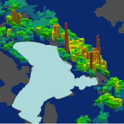
Utah Small Area Demographic & Employment Projections (2019-2050)
- Category: Demographic
- Data Type: GIS Data Layer
- Steward(s): Wasatch Front Regional Council (WFRC), Mountainland Association of Governments (MAG), Dixie MPO, Cache MPO, UDOT
- Abstract: Utah's 4 Metropolitan Planning Organizations, together with UDOT for the state's non-urbanized areas, prepare small area demographic and employment projections to support the transportation planning process. These small area projections are developed from county-level totals released in 2017 by the University of Utah Gardner Policy Institute (GPI). The MPO's and UDOT plan to release updated versions of these GIS layers in 2023, based on updated county projections released by GPI in January of 2022. Two small area geographies are available: Traffic Analysis Zone (TAZ) polygons and City Area polygons. TAZ's average about 1 square mile in size along the Wasatch Front but are larger in rural areas. City Areas are approximations of city boundaries built by combining TAZ polygons.
All links below point at ‘open data’ pages from which shapefiles, KML, CSV, and web services can be downloaded or utilized.
Projected Population & Households for City Areas (through 2050)

Annual projected population and household counts (excluding persons living in group quarters) through 2050 for for ‘City Areas’ that sum the projections for the TAZ geographies that roughly align with each city’s current boundary.
There are no constraints or warranties with regard to the use of this dataset.
Related Resources
- Metadata is available from each of the open data pages listed under the orange 'Downloads' header below. Once an open data page is open, use the 'More v' link (on the left side under the map) to view the full length metadata description.
- WFRC and MAG metropolitan planning organizations (MPOs)
Comments, questions, compliments, or concerns can be directed to Bert Granberg from WFRC at BGranberg@wfrc.org.
Downloads and Web Services
Updates
- last updated June 2019
Projected Population & Households for TAZs (through 2050)

Annual projected population and household counts (excluding persons living in group quarters) through 2050 for Traffic Analysis Zone (TAZ) geographic units.
There are no constraints or warranties with regard to the use of this dataset.
Related Resources
- Metadata is available from each of the open data pages listed under the orange 'Downloads' header below. Once an open data page is open, use the 'More v' link (on the left side under the map) to view the full length metadata description.
- WFRC and MAG metropolitan planning organizations (MPOs)
Comments, questions, compliments, or concerns can be directed to Bert Granberg from WFRC at BGranberg@wfrc.org.
Downloads and Web Services
Updates
- last updated June 2019
Projected Employment for City Areas (through 2050)

Annual projected employment counts (total, and by sectors) through 2050 for for ‘City Areas’ that sum the projections for the TAZ geographies that roughly align with each city’s current boundary.
There are no constraints or warranties with regard to the use of this dataset.
Related Resources
- Metadata is available from each of the open data pages listed under the orange 'Downloads' header below. Once an open data page is open, use the 'More v' link (on the left side under the map) to view the full length metadata description.
- WFRC and MAG metropolitan planning organizations (MPOs)
Comments, questions, compliments, or concerns can be directed to Bert Granberg from WFRC at BGranberg@wfrc.org.
Downloads and Web Services
Updates
- last updated June 2019
Projected Employment for TAZs (through 2050)

Annual projected employment counts (total, and by sectors) through 2050 for Traffic Analysis Zone (TAZ) geographic units.
There are no constraints or warranties with regard to the use of this dataset.
Related Resources
- Metadata is available from each of the open data pages listed under the orange 'Downloads' header below. Once an open data page is open, use the 'More v' link (on the left side under the map) to view the full length metadata description.
- WFRC and MAG metropolitan planning organizations (MPOs)
Comments, questions, compliments, or concerns can be directed to Bert Granberg from WFRC at BGranberg@wfrc.org.
Downloads and Web Services
Updates
- last updated June 2019