2015 Colorado, Green, and Yampa Rivers LiDAR Elevation Data
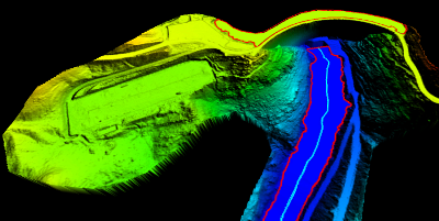

During late Fall of 2015 the Utah Division of Forestry, Fire & State Lands and the U.S. National Park Service acquired ~152 square miles covering ~680 river miles of 8 points per meter LiDAR of the Colorado, Green, and Yampa rivers in Utah and Colorado. The LiDAR collection is mainly of the river course and not the surrounding canyons. A small ~.8 square mile area was also collected in Arches N.P. The .5 meter resolution bare earth DEMs and first-return/highest-hit DSMs in .tif format have a 10.0cm vertical RMSE accuracy and are available for download. The LAS classified point clouds are available from Open Topography. This elevation data was collected October and November of 2015 during low flow conditions.
- Retrieve 2015 Bare Earth DEMs and First Return DSMs via Interactive Map
- Download project Reports and Metadata
- Download shapefiles of the project area, tile indices, breaklines, and river centerlines
This elevation data has a UTM NAD83 (2011) zone 12 north meters NAVD88(GEOID12) projection.
Comments, questions, compliments, or concerns can be directed to Rick Kelson from UGRC at RKelson@utah.gov, or Buck Ehler from DNR at BuckEhler@utah.gov