Earthquake Epicenters
- Category: Geoscience
- Data Type: GIS Data Layer
- Steward(s): UGS
- Abstract: The earthquake database consists of chronological list of earthquake origin time, location, and size for the Utah region.
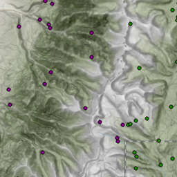
Earthquake Epicenters 1850 to 2016

Earthquake Epicenters 1850 to 2016 represents the modern epicenters of earthquakes in Utah.
Related Resources
The native spatial reference for this dataset is UTM Zone 12N, NAD83 (0.01 meter coordinate precision). There are no constraints or warranties with regard to the use of this dataset. Users are encouraged to attribute content to: Utah Geological Survey, State of Utah, SGID. Earthquake epicenters were created and are maintained by the Utah Geological Survey.
Comments, questions, compliments, or concerns can be directed to Gordon Douglass from Utah Geologic Survey(UGS) at gdouglass@utah.gov or 801-538-4810.
Downloads and Web Services
Updates
- November 2017
Earthquake Epicenters Mining Induced 1968 to 2016
Earthquake Epicenters Mining Induced 1968 to 2016 represents the modern epicenters of earthquakes in Utah that are mining induced.
Related Resources
Downloads and Web Services
Updates
- November 2017