Landslides and Debris Flows
- Category: Geoscience
- Data Type: GIS Data Layer
- Steward(s): UGS
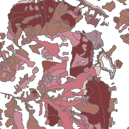
- Abstract: Landslide debris flow paths, deposition areas, and scarps of Utah. Data represents a compilation of existing mapping of landslides at 1:100,000 pre 2007, and new landslide specific data depicting a more detailed inventory at 1:24,000 post 2008. For specific details on each feature class see the included metadata. More detailed information on landslide hazards in Utah is available from the UGS.
Landslide Inventory Polygons
Landslide Inventory Polygons depicts landslide activity and debris flows at scales of 1:24,000 or better and were captured using LiDAR, stereo aerial photography, other data, and field reconnaissance by the UGS. Landslide Inventory Polygons represents the most recent landslide mapping efforts of the UGS, and when possible should be used first.
Comments, questions, compliments, or concerns can be directed to Gordon Douglass from Utah Geologic Survey(UGS) at gdouglass@utah.gov or 801-538-4810.
Downloads and Web Services
Updates
- 2018
Landslide Inventory Mapped Areas
Landslide Inventory Mapped Areas is a reference layer displaying the extent of higher resolution Landslide Inventory Polygon mapping efforts.
Comments, questions, compliments, or concerns can be directed to Gordon Douglass from Utah Geologic Survey(UGS) at gdouglass@utah.gov or 801-538-4810.
Downloads and Web Services
Updates
- 2018
Landslide Compilation Areas
Landslide depositions throughout Utah at a variety of scales and accuracies. This dataset represents a compilation of digitizing efforts by the Utah Geological Survey (UGS), and is not new landslide-specific mapping. Landslides were compiled from all known pre-1989 published and unpublished references available at the time, additional landslide paths were later added from 1989-2007 geologic maps and UGS landslide investigations.
Comments, questions, compliments, or concerns can be directed to Gordon Douglass from Utah Geologic Survey(UGS) at gdouglass@utah.gov or 801-538-4810.
Downloads and Web Services
Updates
- 2016
Landslide Compilation Debris Flow Paths
Landslide Compilation Debris Flow Paths represents debris flow paths throughout Utah at a variety of scales and accuracies. Data was compiled by the UGRC and UGS from all known pre-1989 published and unpublished references available at the time. Additional landslide paths were later added from 1989-2007 geologic maps and UGS landslide investigations.
Comments, questions, compliments, or concerns can be directed to Gordon Douglass from Utah Geologic Survey(UGS) at gdouglass@utah.gov or 801-538-4810.
Downloads and Web Services
Updates
- 2016
Landslide Compilation Scarps
Landslide scarp information of Utah compiled by the Utah Geological Survey (UGS). Data was compiled by the UGRC and UGS from all known pre-1989 published and unpublished references available at the time. Additional landslide paths were later added from 1989-2007 geologic maps and UGS landslide investigations.
Comments, questions, compliments, or concerns can be directed to Gordon Douglass from Utah Geologic Survey(UGS) at gdouglass@utah.gov or 801-538-4810.
Downloads and Web Services
Updates
- 2016