Topographic Map Indices
- Category: Indices
- Data Type: GIS Data Layer
- Steward(s): UGRC
- Abstract: This dataset contains GIS mapping data representing the tile indices for the 24K, 100K, and 250K USGS scanned topographic maps (DRGs).
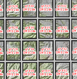
USGS 24K DRG Indices

The USGS Topographic Map tile indices can be used to determine the 7.5 minute, 1:24,000 scale map boundaries for Utah.
Each tile index contains the following attribute fields:
- Name - the name of the map
- OHIO_CODE - code used by USGS
- TILE - the image tile name
- PATH - the directory where the topographic map tile resides
The native spatial reference for this dataset is UTM Zone 12N, NAD83 (0.01 meter coordinate precision). There are no constraints or warranties with regard to the use of this dataset. Users are encouraged to attribute content to: State of Utah, SGID.
Related Resources
Comments, questions, compliments, or concerns can be directed to Rick Kelson from UGRC at RKelson@utah.gov.
Downloads and Web Services
Updates
- Updates to this dataset are not planned
USGS 100K DRG Indices

The USGS Topographic Map tile indices can be used to determine the 30x60 minute, 1:100,000 scale quadrangle map boundaries for Utah.
Each tile index contains the following attribute fields:
- TILE_NAME - UGRC q number
- Name - the name of the map
- TILE - the image tile name
- PATH - the directory where the topographic map tile resides
The native spatial reference for this dataset is UTM Zone 12N, NAD83 (0.01 meter coordinate precision). There are no constraints or warranties with regard to the use of this dataset. Users are encouraged to attribute content to: State of Utah, SGID.
Related Resources
Comments, questions, compliments, or concerns can be directed to Rick Kelson from UGRC at RKelson@utah.gov.
Downloads and Web Services
Updates
- Updates to this dataset are not planned
USGS 250K DRG Indices

The USGS Topographic Map tile indices can be used to determine the 1x1 and 1x2 degree, 1:250,000 scale quadrangle map boundaries for Utah.
Each tile index contains the following attribute fields:
- TILE_NAME - UGRC q number name
The native spatial reference for this dataset is UTM Zone 12N, NAD83 (0.01 meter coordinate precision). There are no constraints or warranties with regard to the use of this dataset. Users are encouraged to attribute content to: State of Utah, SGID.
Related Resources
Comments, questions, compliments, or concerns can be directed to Rick Kelson from UGRC at RKelson@utah.gov.
Downloads and Web Services
Updates
- Updates to this dataset are not planned