Address Data
- Category: Location
- Data Type: GIS Data Layer
- Steward(s): UGRC, Local Government Partners
- Web Application: View
- Abstract: This dataset contains GIS mapping data representing address point locations (near complete) and the address grid system quadrant boundaries (NE, SE, SW, NW) in Utah.
Address Points

Location.AddressPoints is a statewide dataset that contains address point data from all 29 Utah Counties. This dataset is a work in progress and some counties are more complete than others. One person in each county has been identified as the Master Address List (MAL) Authority to eliminate duplication of address point data and to clarify the main person of contact. UGRC is working with each MAL Authority to continually improve this data and work toward monthly updates.
Address Points in Action
The statewide address point layer is used as reference data for the api.mapserv.utah.gov address locators. You can also find the address points in many web mapping applications.
Address Points as a Service
The address points are published as an ArcGIS Online service as well as a Discover service.
Comments, questions, compliments, or concerns can be directed to Zach Beck from UGRC at zbeck@utah.gov or 801-538-3072. For county specific questions, see the contact list for the Master Address Authority at each county.
Related Resources
Downloads and Web Services
Updates
- February 2022 - Carbon, Davis, Millard, Morgan, Salt Lake, Utah, Wasatch, Washington, Weber Counties
- January 2022 - Davis, Salt Lake, Summit, Utah, Washington, Weber Counties
- December 2021 - Davis, Iron, Millard, Salt Lake, Utah, Washington, Weber Counties
- November 2021 - Davis, Rich, Salt Lake, Summit, Tooele, Utah, Washington, Wayne, Weber Counties
- October 2021 - Carbon, Davis, Salt Lake, Sevier, Utah, Wasatch, Washington, Weber Counties
- September 2021 - Davis, Salt Lake, Tooele, Uintah, Utah, Washington, Weber Counties
- August 2021 - Cache, Davis, Kane, Morgan, Salt Lake, Utah, Washington, Weber Counties
- July 2021 - Davis, Millard, Salt Lake, Sanpete, Utah, Washington, Weber Counties
- June 2021 - Beaver, Davis, Emery, Iron, Salt Lake, Utah, Washington, Wayne, Weber Counties
- May 2021 - Cache, Daggett, Davis, Salt Lake, Utah, Wasatch, Washington, Weber Counties
- April 2021 - Davis, Piute, Salt Lake, Sevier, Summit, Utah, Washington, Wayne, Weber Counties
- March 2021 - Box Elder, Davis, Garfield, Iron, Salt Lake, Utah, Washington, Weber Counties
- February 2021 - Carbon, Davis, Salt Lake, Utah, Washington, Weber Counties
- January 2021 - Davis, Iron, Salt Lake, Summit, Utah, Wasatch, Washington, Weber Counties
- Address Points were made public by AGRC on June 27, 2013
Address System Quadrants

Location.AddressSystemQuadrants represents the local and countywide address system quadrants (NE, SE, SW, NW) throughout Utah. Addresses are assigned by local government addressing authorities using a defined addressing system, or grid. An addressing system consists of an origin point (0,0), a north-south axis, and an east-west axis, and a boundary within which addresses are assigned using this particular grid. This convention governs the assignment of addresses and is typically expressed as 100 address ranges per block or 800 address ranges per mile. Updates to this dataset are published periodically.
For additional information regarding Address System Quadrants dataset, read the Utah Local Address Systems document
Comments, questions, compliments, or concerns can be directed to the staff from UGRC at ugrc@utah.gov or 801-538-3665.
Downloads and Web Services
Updates
- September 2021 - Updates near Elsinore/Central Valley/Monroe corners due to recent Elsinore annexation and inputs from Sevier County
- November 2015 - Improvements were made to the Hyrum and Logan address system boundaries
- October 2015 - Updated the American Fork address system boundary to reflect recent annexations
- August 2015 - Improvements were made to the Brigham City, Fishlake, Fremont, Garland, Loa, Lyman, Mantua, Tremonton, and Willard address system boundaries; Updated the Lehi and Santa Clara address system boundaries to reflect recent annexations
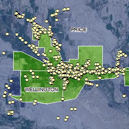
- July 2015 - Improvements were made to the Price and Wellington address system boundaries; updated the Lehi and Provo address system boundaries to reflect recent annexations
- June 2015 - Improvements were made to the Layton and HAFB address system boundaries; updated the Provo and Spanish Fork address system boundaries to match recent annexations
- May 2015 - Updated address system boundaries to reflect annexations in Lehi, Lewiston, and Snowville
- February 2015 - Improvements were made to the Orderville address system boundary to match the municipal boundary
- January 2015 - Updated address system boundaries to match annexations in American Fork, Farmington, Elk Ridge, Grantsville, Lehi, Mendon, Mount Pleasant, Payson, Provo, Spanish Fork, and Washington
- December 2014 - Improvements to the Elmo/Cleveland boundary
- July 2014 - Improvements the Wellington/Price boundary
- June 2014 - Improvements were made to the NSL (North Salt Lake) and Bountiful address system boundaries
- May 2014 - Changed address system name East Carbon-Sunnyside to East Carbon City
- April 2014 - Updated address system boundaries to match recent annexations in northern Utah County; misc improvements in Davis County; adjusted - Laketown/Garden City boundary
- February 2014 - Merged East Carbon and Sunnyside to create the East Carbon-Sunnyside address system
- January 2014 - Improvements were made to the Iron County address system quadrant boundaries and topological errors were corrected statewide
- August, 2013 - Improvements were made to Garfield County and Washington County address system quadrant boundaries