United States Postal Service
- Category: Location
- Data Type: GIS Data Layer
- Steward(s): UGRC and the USPS
- Abstract: These datasets are related to mail delivery. Included are post office locations, zip code PO boxes, and zipcode boundaries in Utah.
USPS Post Offices

Utah Post Offices represents the approximate locations of USPS Post Offices in Utah. Each post office includes the post office name, address, city, zip code, and post office type. Data were originally geocoded from a USPS list of post office addresses.
Comments, questions, compliments, or concerns can be directed to the staff from UGRC at ugrc@utah.gov or 801-538-3665.
Downloads and Web Services
Updates
- February 2018
Zip Code PO Boxes

Utah Zip Code PO Boxes represents the approximate locations of USPS PO Boxes in Utah. Each zipcode's assigned post office has a point, therefore if a post office has multiple zipcodes, it will have multiple points.
The native spatial reference for this dataset is UTM Zone 12N, NAD83 (0.01 meter coordinate precision).
Comments, questions, compliments, or concerns can be directed to the staff from UGRC at ugrc@utah.gov or 801-538-3665.
Downloads and Web Services
Updates
- February 2018
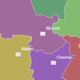
Zip Code Boundaries

Zip Codes Boundaries represent an ongoing effort to approximate the geographic extents of five digit zip codes. The dataset was produced using a combination of methods and is based on several sets of source data. Editing methods include:
- Using local zipcode polygon data obtained from counties and cities.
- Identifying place locations (cities, towns, populated areas, etc.) from the postal service website and address information system (AIS) and building zipcode boundaries around these places.
- Using the 2000 Census TIGER line file’s zip code attributes.
In addition, UGRC has used the locations of mailing addresses known to be valid to fine tune this dataset. The native spatial reference for this dataset is UTM Zone 12N, NAD83 (0.01 meter coordinate precision). There are no constraints or warranties with regard to the use of this dataset. Users are encouraged to attribute content to: State of Utah, SGID.
Comments, questions, compliments, or concerns can be directed to Erik Neemann from UGRC at ENeemann@utah.gov or 385-258-4299.
Downloads and Web Services
Updates
- November, 2019 - Added 84765 polygon for Motoqua in Washington County
- January, 2019 - Added 84059 zip code in Utah County
- February, 2016 - Updated 84321, 84235, 85326, 84332, 84339
- July, 2015 - Split the 84095 (South Jordan) zip code along the Bangerter Hwy to create the new zip code 84009 (South Jordan)
- January, 2015 - Improvements were made to 84773 (Teasdale) and 84775 (Torrey)
- January, 2015 - Adjusted the 84747 (Loa) and 84716 (Boulder) zip code boundaries to follow the address grid quadrant boundaries