Note: New political boundaries are available for the elected officials representing the 2022 districts.
Political Districts (2012-2022)
- Category: Political
- Data Type: GIS Data Layer
- Steward(s): UGRC and The Lieutenant Governor's Office
- Abstract: Utah State House, Senate, School Board Districts, and U.S. Congressional Districts were first used during the 2012 state and federal elections and took effect after the November 2012 general elections. They will remain in effect until after the November 2022 general elections. All political districts are set by the legislature and are updated after a new national census year.
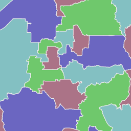
State House Districts 2012 to 2022

The Utah House of Representatives is comprised of 75 men and women elected to two-year terms. Utah House Districts 2012 to 2022 shows the house districts that elected officials represent.
The DIST field contains the House district number.
The COLOR4 field is for use in coloring districts using only 4 colors with no adjacent districts
displayed with the same color.
Statewide Political District Boundaries are drawn by the Utah Legislature and adopted into state law.
Related Resources
Downloads and Web Services
Updates
- This dataset was last updated in 2012.
State Senate Districts 2012 to 2022

The Utah State Senate is comprised of 29 men and women elected to four-year terms. Utah Senate Districts 2012 to 2022 shows the senate districts that elected officials represent.
The DIST field contains the Senate district number.
The COLOR4 field is for use in coloring districts using only 4 colors with no adjacent districts
displayed with the same color.
Statewide Political District Boundaries are drawn by the Utah Legislature and adopted into state law.
Related Resources
Downloads and Web Services
Updates
- This dataset was last updated in 2012.
State School Board Districts 2012 to 2022

The Utah State Board of Education is compromised of 15 districts. Utah School Board Districts 2012 to 2022 shows the school board districts that elected officials represent.
The DIST field contains the State School Board district number.
The COLOR4 field is for use in coloring districts using only 4 colors with no adjacent districts
displayed with the same color.
Statewide Political District Boundaries are drawn by the Utah Legislature and adopted into state law.
Related Resources
Downloads and Web Services
Updates
- This dataset was last updated in 2012.
United States Congressional Districts 2012 to 2022

Political.US Congress Districts 2012 to 2022 shows the U.S congressional districts that elected officials represent.
The DISTRICT field contains the US Congressional district number.
Statewide Political District Boundaries are drawn by the Utah Legislature and adopted into state law.
Downloads and Web Services
Updates
- This dataset was last updated in 2012.