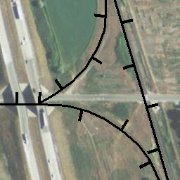
Railroads
- Category: Transportation
- Data Type: GIS Data Layer
- Steward(s): UGRC, U.S. Geological Survey, Federal Railroad Administration (FRA)
- Abstract: Utah Railroads portray the location of railroads in the state of Utah derived from the most recent high resolution imagery available, including 1 foot resolution color imagery, NAIP, 1 meter resolution imagery, and 1 meter USGS DOQs. The dataset has been updated to include cartographic attribution for fine scale representations and also a differentiation between light, heavy, transit, and electrified tracks.
Railroads
This dataset was developed for many uses, including but not limited to, emergency planning. There are no constraints or warranties with regard to the use of this data.
Downloads and Web Services
Updates
- July, 2017
Railroad Mileposts

Railroad mileposts are used to reference locations along railroads by the closest quarter milepost number and railroad division name. The points are intended to improve dispatch of emergency services along mainline railroads.
The statewide roads dataset is maintained by UGRC and created from distances along Utah Railroads in combination with railroad mileposts provided by the Federal Railway Administration.
Downloads and Web Services
Updates
- Created October 1, 2017