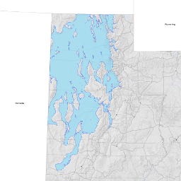
Historic Lake Bonneville
- Category: Water
- Data Type: GIS Data Layer
- Steward(s): UGRC
- Abstract: Historic Lake Bonneville represents the geographic extent of the historic Lake Bonneville shoreline.
Historic Lake Bonneville
This data set was derived from classified shoreline polylines found in the publication Revisiting the deformed high shoreline of Lake Bonneville, by Christine Y. Chen and Adam C. Maloof. More information and other Lake Bonneville related data can be found on Science Direct.
Comments, questions, compliments, or concerns can be directed to the staff from UGRC at ugrc@utah.gov or 801-538-3665.
Downloads and Web Services
Updates
- 2007