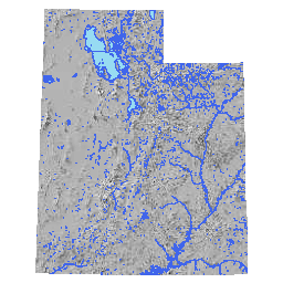
NHD Lakes, Rivers, Streams, and Springs
- Category: Water
- Data Type: GIS Data Layer
- Steward(s): UGRC & USGS
- Abstract: The Lakes, Rivers, Streams & Springs data contains feature layers that are derived from the National Hydrography Dataset (NHD). The NHD is the surface water component
of the National Map created by the United States Geological Survey (USGS). The NHD contains a feature-based database
that interconnects and uniquely identifies the stream segments or reaches that make up the nation's surface water
drainage system. NHD data was originally developed at 1:100,000-scale and exists at that scale for the whole country.
NHD data in it's entirety can be downloaded from the USGS.
The USGS has web-based map services of the NHD and WBD. You are also able to view the USGS services on ArcGIS Server or connect to their server with
https://hydro.nationalmap.gov/arcgis/services.
NHD Lakes

Utah Lakes NHD is the recommended data layer for depicting Utah's lakes, reservoirs, and smaller features, etc. This data is derived from the National Hydrology Database (NHD) compiled by the USGS in partnership with UGRC and other states' GIS programs. The derivation and modification process has been performed by UGRC to provide a general purpose feature class of water bodies. Two fields have been added to this feature class (InUtah and IsMajor) and features have been split at the state boundary.
Comments, questions, compliments, or concerns can be directed to the staff from UGRC at ugrc@utah.gov or 801-538-3665.
NHD Codes
FCODEcan be used to classify water body features by functional type.FNAMEis the name of the water body feature
UGRC maintained codes for cartography
ISMAJORcan be used to query only the major lakes for coarse scale mappingINUTAHcan be used to exclude water bodies outside the state boundary. All water body features that cross the state boundary have been split and attributed (1= in Utah and0= outside Utah)Related Resources
Downloads and Web Services
Updates
- December 2016
NHD Streams

Utah Streams NHD High Res is the recommended data layer for depicting Utah's streams, canals, washes, etc. This is a large dataset that is derived from the National Hydrology Database (NHD) compiled by the USGS in partnership with UGRC and other states' GIS programs. The derivation and modification process has been performed by UGRC to provide a general purpose feature class of streams. Two fields have been added to this feature class (InUtah and IsMajor) and features have been split at the state boundary.
Comments, questions, compliments, or concerns can be directed to the staff from UGRC at ugrc@utah.gov or 801-538-3665.
NHD Codes
FCODEcan be used to classify water course features by functional type.FNAMEis the name of the water course
UGRC maintained codes for cartography
ISMAJORcan be used to query only the major water courses for coarse scale mappingISSUBMERGEDcan be used to exclude the hydrologic network features that have been added across water bodies to the NHD dataset for linear water flow modelingINUTAHcan be used to exclude water courses outside the state boundary. All water courses features that cross the state boundary have been split and attributed (1= in Utah and0= outside Utah)
Related Resources
- Points of Diversion depicts agricultural irrigation and other diversion points at or along water features. This dataset is stewarded by the Utah Division of Water Resources. Comments, questions, compliments, or concerns can be directed to Lee Eschler from DNR at LeeEschler@utah.gov.
- Source Water Protection Zones (Drinking Water) are maintained by the Utah Division of Drinking Water. This dataset is considered a protected record. Those with a legitimate need for this data are invited to contact Kate Johnson from DEQ at KJohnson@utah.gov.
- Water-Related Land Use characterizes the type of water usage (irrigation, crop type, urban uses, etc) for land, statewide (see SGID Planning for more detail).
- National Hydrography Dataset
- USGS / National Map - Streamer
Downloads and Web Services
Updates
- December 2016
NHD Springs

Utah Springs NHD is a point layer derived by UGRC from the NHD.
Related Resources
Comments, questions, compliments, or concerns can be directed to the staff from UGRC at ugrc@utah.gov or 801-538-3665.
NHD Codes
FCODEcan be used to classify spring features by functional type.GNIS_Nameis the name of the spring feature
Downloads and Web Services
Updates
- July 2015