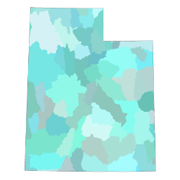
Watershed Areas
- Category: Water
- Data Type: GIS Data Layer
- Steward(s): UGRC, BLM
- Abstract: Watershed areas represent the watershed area boundaries throughout Utah.
Watershed Areas
This data set is intended to be used as a tool for water-resource management and planning activities, particularly for site-specific and localized studies requiring a level of detail provided by large-scale map information.
HUC_8contains the 8 digit hydrologic unit code for the 4th level sub-basinsHU_8_NAMEcontains the sub-basin nameHUC_10contains the 10 digit hydrologic unit code for the 5th level watershedsHU_10_NAMEcontains the watershed nameHUG_12contains the 12 digit hydrologic unit code for the 6th level subwatershedsHU_12_NAMEcontains the subwatershed name
Comments, questions, compliments, or concerns can be directed to the staff from UGRC at ugrc@utah.gov or 801-538-3665.
Downloads and Web Services
Updates
- Unknown