By Matt Peters on Feb 05, 2018
Maps on the Hill 2018
This article will take 2 minutes to read
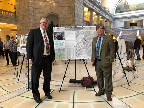
The seventh annual Maps on the Hill event was held on January 30, 2018, in the Utah State Capitol building rotunda. This annual event provides a valuable opportunity to raise awareness of the GIS field and to engage legislators in discussion of GIS-related issues. There was a great turnout this year, with just under fifty displays of maps and apps. These displays were created by various contributors, including Utah cities, universities, state and county departments, offices, and more, and covered a range of topics, such as showing vulnerability during an earthquake in Salt Lake City, mapping Utah film history, and mapping Uber rides in the Salt Lake Valley. Each display told a story of different GIS data, and the displays were judged and awarded based on their ability to convey the value of GIS-based solutions.
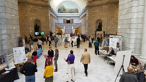
A three-judge panel, consisting of Mike Canning (Deputy Director, Utah Department of Wildlife Resources), Amber Knapp (State Government Account Manager, ESRI, formerly of Cook County, Illinois), and Zach Posner (Chief Information Officer, Salt Lake County) rated the displays on overall effectiveness, visual appeal, data integration, and innovation.
The 2018 winners
Best of Show
Salt Lake City Public Utilities
Awards of Excellence
Utah Department of Natural Resources, Division of Forestry, Fire and State Lands and Division of Oil, Gas and Mining
Utah Department of Natural Resources, Division of Wildlife Resources
Utah Department of Environmental Quality, Division of Water Quality
Utah Community Development Office
Most entries can be viewed in the Maps on the Hill PDF booklet. Be sure to give the photo album a view. And, you can look back on all the Maps on the Hill events on our website.
Thank you to our judges, participants, and volunteers for making this a quality, informative event.